
Nine years ago South Africa put in place an innovative information management system designed to monitor and protect its seas. The country is surrounded by the Atlantic and Indian oceans on its southern, eastern and western borders.
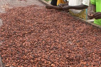
The oceans are an important source of income and employment. The ocean economy contributed about R110 billion (around US$5.7 billion) to South Africa’s GDP in 2010. A 2019 government report projected that, by 2033, this would rise to R177 billion (US$9.2 billion), as well as creating just over one million jobs. The main sectors in ocean industries are maritime transport, fisheries and aquaculture, mineral resource exploitation and tourism. The potential for economic growth is also reflected in the country’s Operation Phakisa Oceans Economy plan.
But, while the sheer extent of its maritime domain presents many opportunities, it also comes with governance challenges. It’s hard to monitor and plan for ocean-related economic development and conservation.
That’s where the National Oceans and Coastal Information Management System (OCIMS) comes in. It was conceptualised within the country’s Department of Forestry, Fisheries and the Environment in 2012 and officially launched in 2015 in partnership with the Council for Scientific and Industrial Research (CSIR).
While the system is tailored to South Africa’s national priorities, it was inspired by other mature ocean information systems around the world, such as those in Australia and the US.
The system brings ocean observations made by various national agencies into one platform. The major users are also partners who contribute to the system by sharing data and expertise.
For example, data capture apps on the system are used to share measurements made on aquaculture farms and inform users on the potential risk of red tides (a common name used for harmful algal bloom). Boat-based whale watching operators contribute their marine species sightings data towards biodiversity assessments. All this data can be analysed by scientists and their findings used to advise on policy options or compliance and enforcement actions.
In a recent paper we looked at how the system emerged and why it’s been important for the protection of the country’s oceans. We found that it was providing value for money: it helped mitigate environmental or security risks, resulting in significant cost savings for the public and private sectors. It also promoted dialogue across government departments, non-profit organisations and the private sector. This facilitates a coordinated approach to ocean governance.
The approach taken to establish the system could benefit other countries looking to build their own ocean and coastal system knowledge platforms.
Data-driven
As the COVID pandemic demonstrated, informed decisions cannot occur without access to data. Historical and operational data provides situational awareness, informs policy and supports long-term planning and management.
To this end, the Department of Forestry, Fisheries and the Environment, working with the South African Environmental Observations Network, created the Marine Information Management System. It’s an essential component of the overall OCIMS system. It preserves, discovers and disseminates long-term data. It is internationally accredited and bound by best international standards and practices.
The system also makes data more accessible by providing user-specific data capture applications, complemented by data visualisation platforms such as webmaps and dashboards.
Supporting decisions
Another of the system’s aims is to provide tools for supporting decisions. Such tools can be used for coordination and response (for example, monitoring avian influenza). They can also be used in compliance and enforcement initiatives, such as tracking vessels.
The Fisheries and Aquaculture tool, for instance, supports both the public and private sectors by providing warnings on potentially harmful algal blooms, a phenomenon that can threaten aquaculture farms or affect fish and lobster populations. It detects algal blooms through satellite observations; this satellite data is complemented by information from those in the field, combining to create an active, interactive decision-making tool.
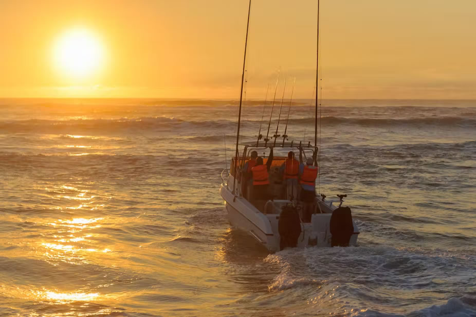
Then there’s the Integrated Vessel Tracking tool. It monitors vessels’ movements and is used daily by the institutions mandated to enforce security at sea, such as intelligence services and the navy, to detect or intercept illegal activities at sea. Researchers say the tool has worked to prevent illegal fishing and marine pollution. It’s also been instrumental in the interception of drug-loaded vessels.
Collaboration
All of these successes have been made possible by secure, sustained funding by the South African government. That has instilled a sense of security in collaborators and partners; they provide invaluable co-funding, expertise and data, saving money and building resilience into the system.
Some of the system’s tools have been shared with other countries in the southern African and Indian Ocean regions.
As the project’s visibility increases, new opportunities for collaborations are emerging. Government departments, non-profit organisations and the private sector are coming forward with offers to share data. The system is also being proposed for use by academic scientists in their proposals.
One of the main lessons emerging from our research, which may be of interest to other countries wanting to launch similar initiatives, is that it’s crucial to involve a system’s major users in development from the start. Formalised stakeholder interactions ensure that the system directly responds to major user needs. That makes it immediately relevant and useful.